
Search Orchard Park Streets by Address
A street directory search in Orchard Park works best as a record chain, not as a roster. Erie County’s parcel tools identify a situs, or property, address and the parcel keys tied to it. The recorded-deed system then supplies legal transaction details. Town permit and planning material can add a dated administrative role. Historical reverse directories may add a listed household or subscriber for a particular year. Those roles must remain separate. A parcel owner can be a trust, business, estate, or nonresident owner, and an address in a directory can be a home, office, boarding location, or telephone listing.
- Enter the complete delivery address in the USPS ZIP Code Lookup. Keep the street number, directional, suffix, postal city, and ZIP exactly as returned.
- Use the Town’s assessment and property route or Erie County On-Map to locate the parcel. Record the raw SBL, PIN, situs fields, roll date, and the owner and mailing fields separately.
- Move from the parcel to Erie County Clerk BrowserView with a party name, book and page, instrument number, map or parcel mode, and an appropriate date range. The Clerk does not provide a street-address index.
- For construction or land-use questions, ask the Town Building or Planning office for an existing record by exact address, record type, and date range. A request may be needed because no public permit-history screen was located.
- For a past address association, check a period-appropriate reverse or criss-cross directory, then compare the year and entry type with a deed, map, newspaper, or other dated record.
The Orchard Park street directory is therefore strongest when it reports the source, date, and relationship rather than making an undated claim about a household. A narrow Erie Board of Elections FOIL request can seek a lawful existing record by town, ward, district, year, field, and sort format, but the research found no public voter-by-street screen.
Orchard Park Parcel Keys First
Normalize an Orchard Park address before following it across systems. Preserve the raw address, legal municipality, postal city, and both ZIP fields. The county PIN is the broader parcel identifier: its digits contain the county SWIS, section, block, and lot. An SBL is the section, block, and lot reference, and punctuation may differ among a tax document, On-Map, and a Clerk record. Book and page or instrument data belong to the title trail, not to the postal address.
- Parcel
- A defined piece of land in the county assessment system, identified by SBL or PIN rather than by a name alone.
- Situs address
- The location of the parcel. It differs from an owner’s mailing address, which may point to another city or recipient.
- Plat or map reference
- A recorded map or subdivision reference used with parcel and legal-description fields to identify land in the Clerk’s records.
- Criss-cross directory
- A reverse directory arranged by address, used as a dated clue about a listed household, subscriber, or business.
Do not convert an old label into a modern one without support. The research found no official Orchard Park address-authority roster or comprehensive street-renumbering crosswalk. A legal description, map sheet, historic place name, or confirmation from the Assessor is a better bridge.
Orchard Park GIS Street Fields
The Erie County parcel REST layer documents the fields behind the county parcel view. It distinguishes the physical location from owner and mailing data. That distinction is central to an Orchard Park street directory: ADDNUM, ADDNAME, ADDRESS, CITYTOWN, and LOCALZIP describe the situs. OWNER1, OWNER2, MAILAD1, STREET, CITY, ZIP, and ZIP4 describe ownership and mail. Neither group alone establishes occupancy.
The official county field schema is shown below.
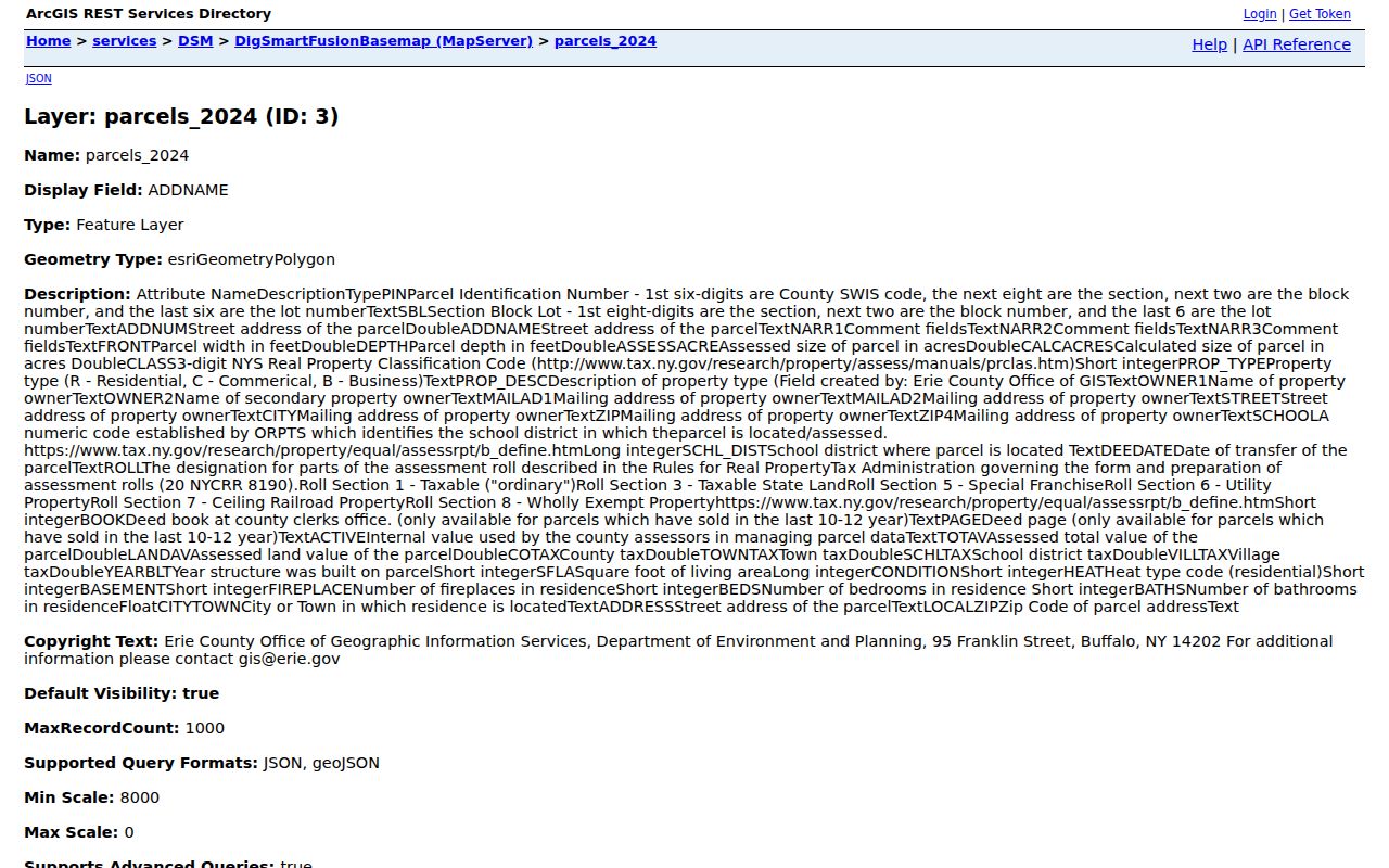
Use the displayed field names as a checklist when saving a source note, especially where situs and owner-mailing values disagree.
| Field or control | Type | When used | What it establishes |
|---|---|---|---|
| Street number and street name | Address text | Start of an address query | Parcel situs candidate |
| Owner name | Text | Optional name query | Current assessment owner, not occupant |
| SBL or PIN | Exact text | Parcel match | County-wide parcel key |
| Map click | Map selection | Street browsing | Selected parcel and report context |
LOCALZIP and ZIP layer | Result field or layer | Postal context | Situs ZIP or Census layer, not a people result |
| Owner mailing fields | Result fields | Compare with situs | Mail recipient location when present |
DEEDATE and BOOK/PAGE | Result fields | Clerk bridge | Recorded-document lead when present |
| Value, class, and roll metadata | Result fields | Assessment context | Tax and data-vintage context, not residence |
On-Map supports street browsing by address search, pan, and parcel selection. Its documented layers include parcels, roads, ZIPs, schools, legislative districts, water, wetlands, flood data, agricultural districts, and soils. No radius or buffer tool was confirmed, so adjacent parcels should be inspected through map selection rather than described as a fixed-distance search.
Orchard Park Deed Search Bridge
The Erie County Clerk holds deeds from 1808 forward, with an online index from 1986 and deed images from 1960. BrowserView is the Orchard Park street directory’s legal-record bridge, but it must be reached from parcel information because the official system does not search by address. Search modes include Party Name, Document Type, Town, date, consideration, Instrument Number, Book/Page, Map Number, Parcel ID, District, map and parcel variations, and legal-description lines. Party Name uses last name followed by first name, without a comma.
The Erie County Clerk BrowserView interface is the source for these filters and result controls.
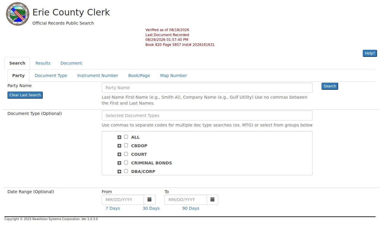
A result can identify record type, instrument, recording date and time, book and page, page count, consideration, map or parcel reference, legal lines, Town, direct or indirect party, notes, and linked documents. Image access may require login or may not be available. For older work, use the Graves Index, the public terminals at 92 Franklin Street, or a Clerk request rather than treating an absent online image as proof that no record exists.
Orchard Park Building Record Requests
Town Building and Code Enforcement records are another address-keyed source. The Town’s permanent public-inspection categories include applications, plans, permits, certificates of occupancy, stop-work orders, operating permits, inspections, complaints, investigations, and fees. The public source set did not locate a searchable permit-history screen. The practical route is a request to the Building Department naming the exact situs, permit or record type, and date range. Private identifiers or contact details may be redacted.
The Town’s Building Inspector and Code Enforcement page provides the official forms and department route.
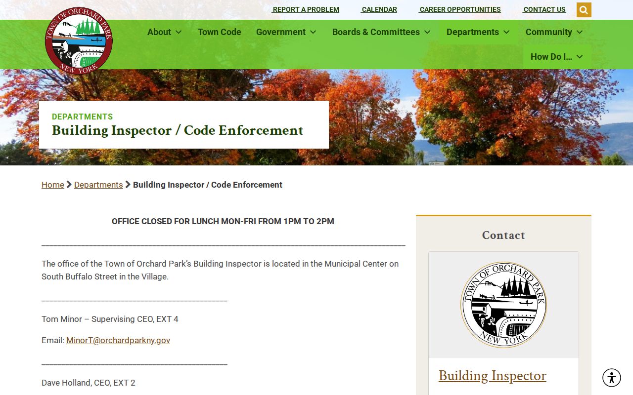
A permit applicant, contractor, or owner authorization is a dated administrative role. It should not be relabeled as a current household listing.
Orchard Park Planning Packet Clues
Planning packets can add a different layer to street research. They may name an owner authorization, applicant, agent, consultant, project address, and public meeting date. The Town Planning Department states that resubmissions are due 14 days before a meeting. That timing can help distinguish the correct packet cycle when a parcel has more than one application.
Ask for the existing agenda, packet, minutes, or application by project address and date. A planning appearance records an application or representative relationship, not proof that every named person occupied the parcel.
Note: Preserve the packet date and source role because a later approval or resubmission can change the party list without changing the property address.
Orchard Park Street Record Coverage
Address-keyed sources have different custodians and limits. This Orchard Park street directory table keeps the record relationship visible before a name is compared across systems.
| Address source | Custodian | Street-level value | Access path |
|---|---|---|---|
| Parcel and assessment | Erie GIS and Assessor | SBL/PIN, situs, owner, mailing, values, improvements | Online viewer; Assessor confirmation |
| Recorded deeds | Erie County Clerk | Parties, recording, legal description, book/page | BrowserView, public terminals, request |
| Tax record | County or Town tax service | Bill, owner/address, payment or delinquency context | Online or counter, by year |
| Permit and code file | Town Building/Code | Work, applicant, owner, inspections, complaints | Forms, office request, or FOIL |
| Planning packet | Town Planning Board | Applicant, owner authorization, agent, meeting | Agenda, packet, or request |
| Voter record | Erie Board of Elections | Requested registration fields by lawful geography and year | FOIL; protected fields and uses apply |
| Reverse directory | B&ECPL Grosvenor Room | Dated address, subscriber, or household clue | Library, microfilm, and digital collections |
For a current parcel question, the online parcel view, Town Assessor, Clerk terminal, and a precise written request are complementary channels. A road name alone is not enough for a reliable whole-street result. Record the starting address, each selected SBL, source date, and the Clerk key used for each parcel.
Orchard Park Historic Street Listings
Historic address work belongs in the library collections after the parcel and deed trail is dated. The Buffalo City Directory has a reverse-address section from 1929 to the present. Buffalo Address Books have a reverse section for 1883 through 1916, and the Courier Express has a 1931 reverse phone directory. The Haines Directory covers all Erie County from 1968 to the present. These are address-to-listing tools, but each series has gaps and different inclusion rules.
The B&ECPL directory holdings guide sends Orchard Park research through East Aurora, Buffalo Southeast Suburban, Buffalo Southtowns, Buffalo South Suburban, and East Hamburgh references. Read a historic entry for its name, spouse or widow notation, occupation or employer, h. home marker, street address, and page. It may refer to a household, office, business, or phone subscriber, so the entry needs a date-specific label. The historical shelf is covered in greater depth in the Orchard Park Directory Book.
Orchard Park Street Names Across Time
Place labels are part of the search. Older material can appear under Hamburg, East Hamburg, East Hamburgh, or Orchard Park. The village was known as Orchard Park in 1882, formally acquired that name in 1921, and the Town was renamed in 1934. Those changes explain why a period directory, deed, or map may use a name that does not match a current parcel display.
Use the date on the source first, then compare the legal-description line, street suffix, railroad or site anchor, and map context. No official local renumbering crosswalk was located. A missing modern-name hit is a reason to try the historical place variants, not a reason to conclude that the address did not exist.
Limits of an Orchard Park Street Directory
An Orchard Park street directory cannot turn parcel data into a complete occupancy list. The county map is query context, not a legal survey, and its update timing is not guaranteed. An owner, tax mailing recipient, permit applicant, court party, and dated directory listing describe different relationships. Utility customer data was not located as a public source. DMV personal information is restricted, and protected voter or Address Confidentiality Program records may be withheld or use a substitute address.
Lawful personal research. New York FOIL, Public Officers Law Article 6 §§84–90, applies to existing agency records subject to exemptions. Do not use address records to stalk, harass, or harm anyone, and do not infer a protected physical address.
Where an agency has no online history screen, request the existing record from the custodian with an address, date range, and record class. If the response says sealed, confidential, unavailable online, or no image, preserve that limit and use the stated official next channel.